Martinique from the sky: reading the sea from an ultralight
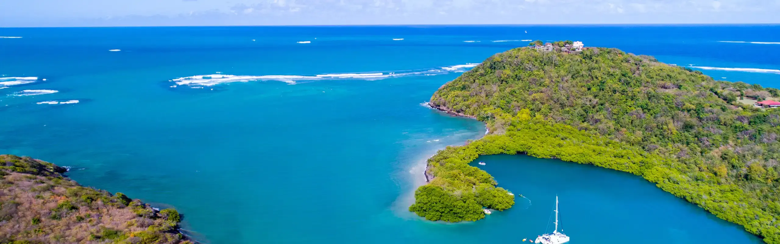
From a boat, you see a surface. From an ultralight, you see a map: the whole barrier reef comes into view, the color of the water gives away its depth, and the islets finally fall into the order that explains them.
The color of the water reads like a map
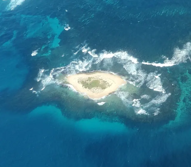
It is the first thing that strikes you when the aircraft leaves the ground: the sea stops being blue. It becomes a continuous gradation, from milky turquoise to almost black blue, and every shade corresponds to a depth. Pale sand sends the light back to the surface and gives white; seagrass beds absorb it and turn dark green; beyond the drop-off, nothing comes back up and the water turns to ink.
From a boat, this reading is impossible: the eye is a meter above the water and the reflection of the sky masks everything. That is why a short flight shows something of the bay that no day of sailing will show. You will not see the detail better, you will see the structure.
The barrier reef, invisible from a boat
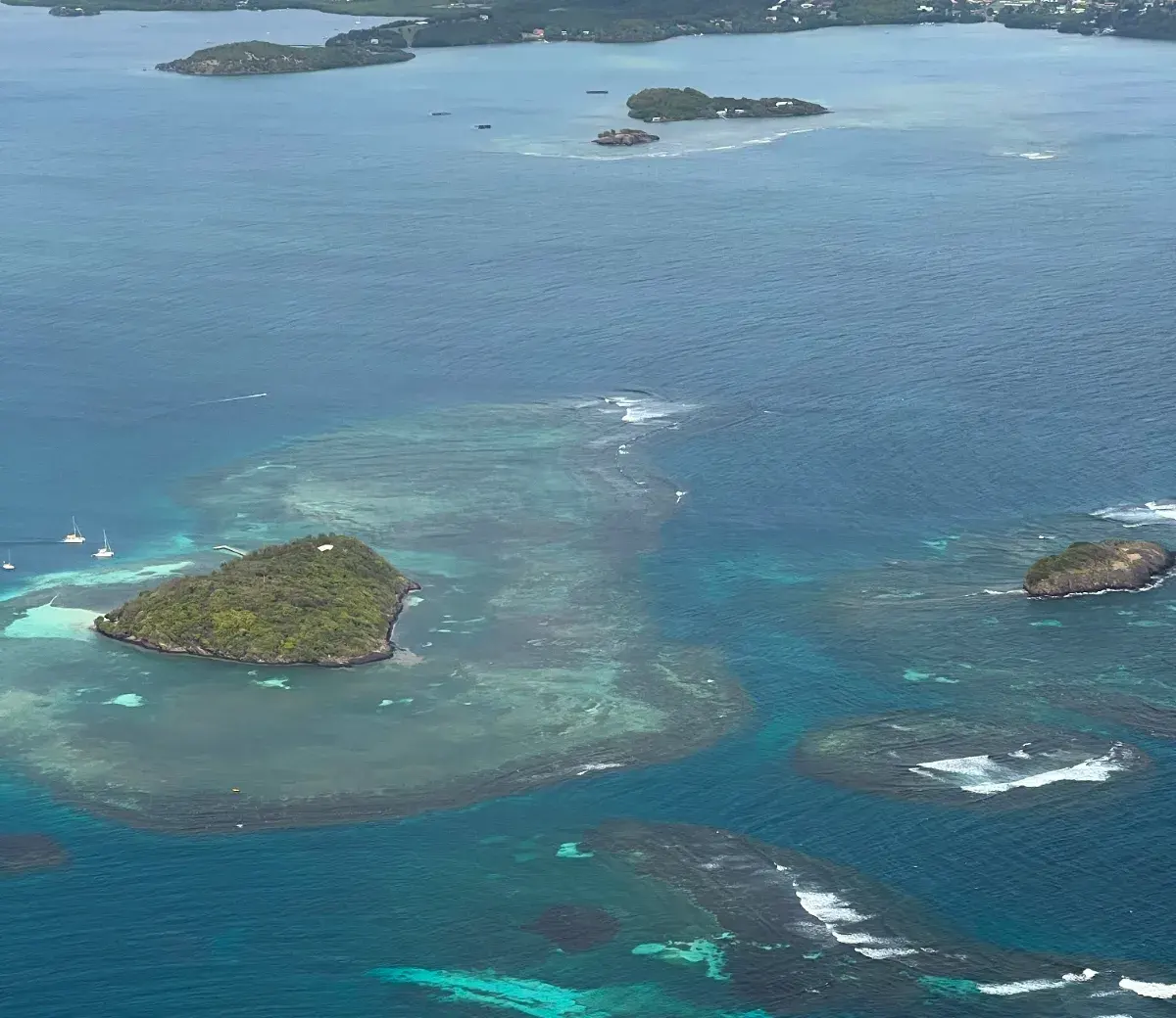
Martinique's windward coast is protected by a barrier reef about 25 kilometers long, largely submerged under 5 to 10 meters of water. Only a few shoals break the surface, and the reef is cut by channels through which the Atlantic swell enters. Between it and the coast, the bottom falls away to 12 meters, sometimes 30.
From the ground, this reef does not exist: you can make out a line of foam offshore, nothing more. From above, it appears all at once in its entirety, with its channels and its gaps, and you understand in a second why the Baie du Robert is calm while the Atlantic breaks offshore. That is the view the flight offers and that nothing else replaces.
A reef built by algae too
The islets and the fringe of mangrove
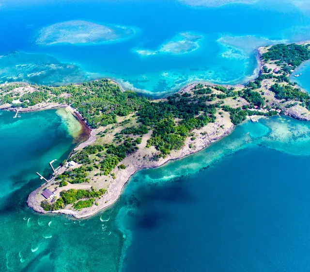
Sheltered by the reef, the sea deposits. The result is immense seagrass beds, the shoals of pale sand known here as the white-sand shallows, or fonds blancs (exactly what they are, and what you do there, is detailed in the guide to îlet Chancel (Chancel islet)), and a fringe of mangrove that lines the coast wherever the water is calm enough for mangroves to take hold. The islets line up in this shelter, from Le Robert to Le François.
In flight, mangrove is recognizable by its color: a thick green, almost black, that stands out against the turquoise and follows the coastline exactly. What you fly over in a few seconds takes far longer by boat, and that is also the best argument for doing both: the flight gives the plan, the boat trip gives the detail.
Light and visibility
Three phenomena decide what you will see, and none depends on the tourist season. The first is the trade wind: the easterly wind driven by the Azores high, which blows all year round. It is what keeps the air clear, and it is also what makes the Atlantic coast choppier than the Caribbean coast.
The second is the daily cycle of clouds. The morning dawns clear, with cumulus clouds racing by in the flow; from midday, convection develops over the high ground and showers become more likely. For a flight, the consequence is simple: the most readable sky is the morning's.
Dust haze, the factor nobody anticipates
These three factors explain why the takeoff time is decided as close to the date as possible, with the pilot, and not at the time of booking. It is not commercial vagueness, it is the only way to get you off the ground in the window when the sky has something to show.
Photographing from a two-seater
The constraint is different from anything you know on the ground: you are in a light aircraft, there is wind, the aircraft moves, and nothing that is not firmly held may be left loose. The rest is a matter of simple settings.
What works
- Tie the camera or phone to your wrist, every time, before takeoff.
- Raise the shutter speed: it is vibration, not light, that ruins photos in flight.
- Aim forward and down rather than at the horizon: the color of the water reads best looking down.
- Ask over the intercom for a second pass over a subject: the pilot can often offer one.
What to avoid
- Take out anything that is not tied down: an object lost in flight is a danger to the aircraft.
- Press the lens against the canopy, which sends reflections and scratches into the image.
- Film the whole flight continuously: the card fills up and you are no longer looking at anything.
- Count on the digital zoom, which vibration turns into guaranteed blur.
The briefing is the right time
Our flight options
The flights are operated by Dtek under the WanakAéro brand, in a two-seat ultralight, one passenger at a time. The length you choose does not change the nature of the flight, it changes the extent of what you fly over. The exact route, for its part, is decided at takeoff, with the wind and the ceiling of the day.
Three flight lengths, three areas covered
Briefing, flight and debriefing in all three cases. The type of flight (discovery flight, first flight or intro flying lesson) is chosen with no effect on the price.
Sources
See the 5 sources for this guide
- Battistini R., Les récifs coralliens de la Martinique (in French) (Observatoire de l'eau de la Martinique)
- État de santé des récifs coralliens, herbiers marins et mangroves de Martinique, bilan 2020 (in French) (Ifrecor)
- Coraux : état et suivi des récifs de la Martinique (in French) (DEAL Martinique)
- Les brumes de sable : origine, suivi et procédures (in French) (Madininair, qualité de l'air en Martinique)
- Relevés et normales climatiques de la Martinique (in French) (Météo-France Martinique)
Photo credits
Photographs by AGEM Excursions, except those listed below:
- Petite grenade, Mickaël BRUNO, CC BY-SA 4.0
- Ilet Long, Mickaël BRUNO, CC BY-SA 4.0